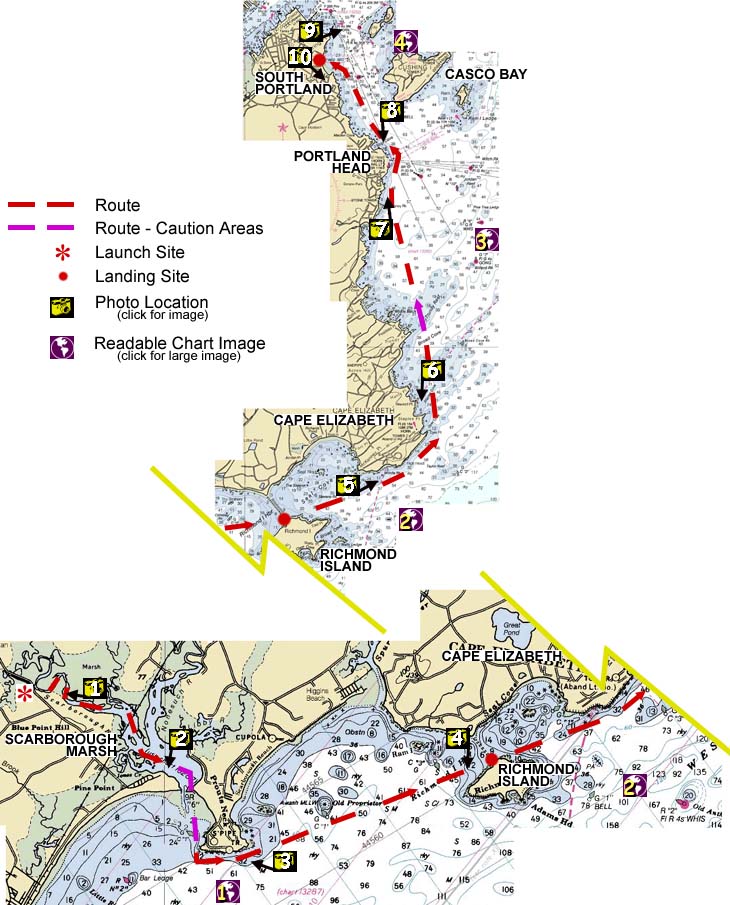
Scarborough Marsh, ME to South Portland, ME
DRIVING DIRECTIONS TO LAUNCH AND TAKEOUT
My brother and I put in at the Scarborough Marsh Nature Center and paddled out of the marsh past Pine Point, braving the choppy harbor entrance. We rounded Prouts Neck and headed for Richmond Island, stopping for lunch on the beach next to the breakwater. Paddling northeast, we rounded Cape Elizabeth and headed north toward Portland Head Light. After staring in awe at the marvelous head, we landed on Simonton Cove Beach, near the Spring Point Jetty. In all, we covered about 17 nautical miles.

Image descriptions are keyed to the map above; you can also click on the map to see the image


You are visitor number
© 2000 Daniel E. Smith. Last updated 9-4-00